EU delays Copernicus satellite images of Strait of Hormuz
US request coincides with expanded strikes on Iran, transparency shifts from public data to controlled channels
Images
 Photo of Jeremy Hsu
arstechnica.com
Photo of Jeremy Hsu
arstechnica.com
 Smoke and flames rise after an explosion in Bandar Abbas in Iran’s Hormozgan province before dawn on Friday. Photograph: Social Media/Reuters
theguardian.com
Smoke and flames rise after an explosion in Bandar Abbas in Iran’s Hormozgan province before dawn on Friday. Photograph: Social Media/Reuters
theguardian.com
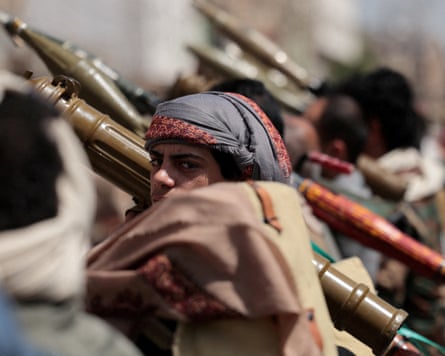 Houthi fighters take part in a pro-Iran rally in Sana’a, Yemen, in April. Photograph: Khaled Abdullah/Reuters
theguardian.com
Houthi fighters take part in a pro-Iran rally in Sana’a, Yemen, in April. Photograph: Khaled Abdullah/Reuters
theguardian.com
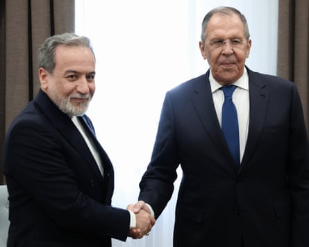 Iran’s foreign minister, Abbas Araghchi (left), meets his Russian counterpart, Sergei Lavrov, in Kyrgyzstan on Friday. Photograph: Russian Foreign Ministry Press Service/AP
theguardian.com
Iran’s foreign minister, Abbas Araghchi (left), meets his Russian counterpart, Sergei Lavrov, in Kyrgyzstan on Friday. Photograph: Russian Foreign Ministry Press Service/AP
theguardian.com
An explosion hit Bandar Abbas before dawn on Friday as the Trump administration widened its strikes across Iran, with the Guardian reporting attacks reaching as far as the Caspian Sea. Tehran responded with missile and drone fire against US bases and allies across the region, while Trump warned of “major military punishment” for Iran and its Houthi partners over attacks near the Bab el-Mandeb strait. In Brussels, the EU has begun delaying the release of Copernicus satellite images of shipping lanes near the Strait of Hormuz by 24 hours, according to Ars Technica, following a US request made earlier in the war.
The two moves—more kinetic pressure in the Gulf and less immediate visibility over its chokepoints—arrive as commercial shipping tries to price risk in real time. The Guardian says Houthi strikes on two Saudi tankers pushed oil above $100 a barrel and forced some vessels to reroute via longer passages, while insurance costs through the southern Red Sea doubled for some companies. The same reporting describes traffic through the Strait of Hormuz dropping sharply, with tankers avoiding the passage even as Washington and Tehran remain at odds over who controls it in practice. That is the operational backdrop for the EU’s decision: Sentinel-1 and Sentinel-2 imagery has been used by journalists and open-source investigators to track damage and movements, and a one-day delay does not stop scrutiny so much as make it less timely.
Ars Technica frames the Copernicus change as a Council of the EU decision taken on July 13, after the US asked on May 26 for restrictions during a ceasefire window that later ended. The article notes that US satellite firms have already tightened access to Iran-war imagery after government security concerns, pushing reporters toward European public data and commercial European providers. Bellingcat has built tools around Sentinel imagery, and major US newspapers have used Copernicus material to assess strikes and base damage—work that becomes harder when the freshest frames arrive after markets and navies have already reacted.
On the US side, the Guardian describes competing claims around diplomacy: the New York Times reported Iran rejected a US ceasefire proposal delivered by Iraq’s prime minister, Ali al-Zaidi, while Iraq later disputed that account; Rubio publicly claimed Iran was “begging” for a ceasefire. Trump, speaking on Truth Social and to Axios, mixed deterrence messaging with escalation hints, saying Iran had not “received enough pain yet,” and warning China and Russia against selling weapons to Tehran even as Iran said it was consulting both.
Friday’s immediate reality is that ships broadcast ownership and flag details to the Houthis to seek safe passage, while governments argue over who said what in private. The public satellite feed that helped outsiders verify the movement of ships and the aftermath of strikes will now arrive a day late.