Pokémon Go scans train delivery robots
Niantic Spatial sells visual positioning system built from player images, gamified mapping turns leisure into navigation infrastructure
Images
 Ever played Pokémon Go? You may have helped train delivery robots
euronews.com
Ever played Pokémon Go? You may have helped train delivery robots
euronews.com
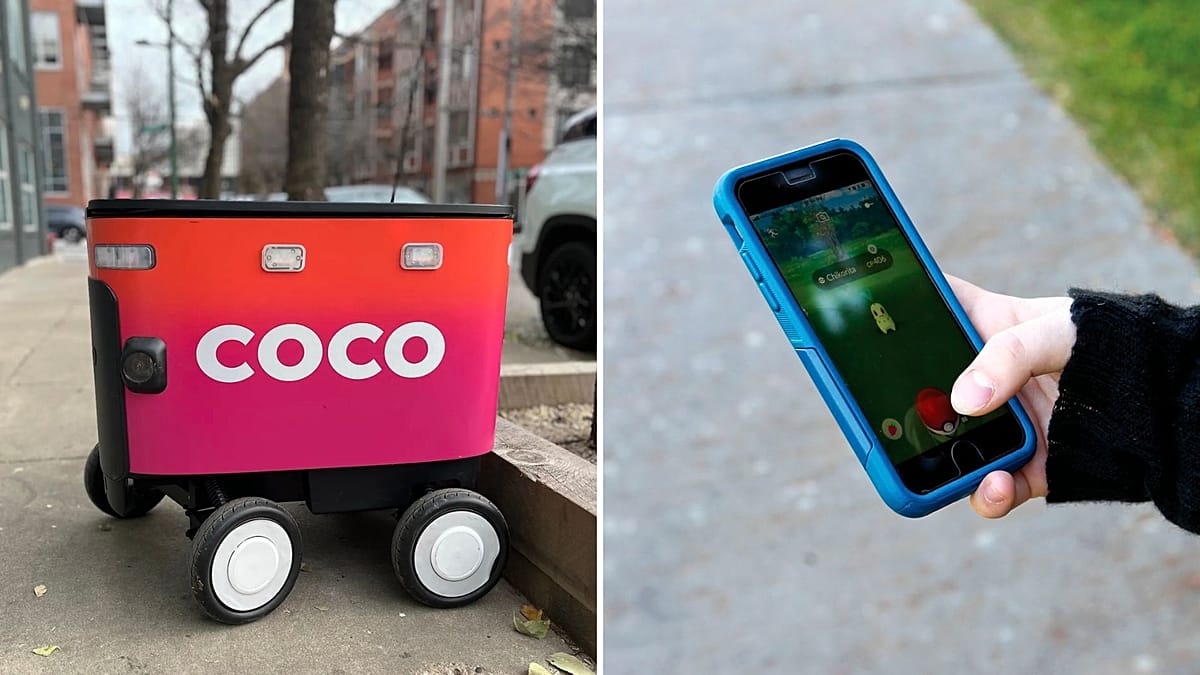
More than 30 billion images collected through Pokémon Go are now being used to help delivery robots navigate city streets, according to Euronews. Niantic Spatial, a unit of the game’s developer, says it has turned player-submitted scans of streets, parks and landmarks into a “visual positioning system” that can locate devices using environmental cues rather than relying solely on GPS.
The new customer is Coco Robotics, which operates roughly 1,000 small wheeled delivery robots in cities including Los Angeles, Chicago and Helsinki. Coco says the system will combine GPS with Niantic’s visual positioning to improve localisation in dense urban areas and indoors, where satellite signals are less reliable. The company says its fleet has completed around half a million deliveries.
Euronews reports that Pokémon Go’s “Field Research” tasks have pushed players to film and photograph public spaces in exchange for in-game rewards, building a map that is not just geometric but visual: what a street corner looks like from different angles, in different light, with different obstructions. Niantic’s CEO John Hanke framed it as a shared engineering problem—making a cartoon character move plausibly through the world and making a robot move safely through it.
The shift illustrates how entertainment products increasingly double as data-collection systems. Google’s reCAPTCHA trained text recognition and image classification; Street View cars turned photography into a map that could be monetised across navigation and advertising. Pokémon Go adds a more scalable layer: users carry the cameras, choose the routes, and supply updates as cities change.
The commercial logic is straightforward. High-quality localisation is expensive to build from scratch, and last‑mile robotics depends on it: a robot that cannot reliably identify where it is will either stop, take unsafe decisions, or require remote human intervention. A game that persuades millions of people to scan pavements and statues produces a dataset that robotics firms can rent instead of replicating.
Niantic has said participation in scanning features is optional and requires opt-in, Euronews notes. But the incentive design is the point: rewards are calibrated to make “optional” feel like progress. The user experiences a game mechanic; the company receives a continuously refreshed layer of machine-readable reality.
Coco’s robots will still face the hard problems—pedestrians, roadworks, weather, vandalism—but the partnership outsources one of the most capital-intensive inputs: knowing where you are. A decade after Pokémon Go’s launch, the rare Snorlax hunt has become a navigation product sold to delivery fleets.
In Helsinki, one of Coco’s operating cities, the same scanned sidewalks that helped place a digital Pikachu are now being used to keep a real robot from drifting into traffic.